Northeast Seattle Link Connections open house (LIVE COVERAGE)

The University of Washington and Capitol Hill Light Rail Stations are now just one year a way from opening to trains and passengers. How is transit going to get you to those stations?

Ahead of the University Link light rail extension opening in the spring of next year, King County Metro is proposing a slew of changes to Northeast Seattle Metro routes to better integrate service with the next link in the light rail chain: the University Link.

Tonight, Thursday, March 26, from 6-8PM at University Heights Center, Room 209 (5031 University Way NE), King County Metro holds their last open house meeting about these proposed changes (previous open houses were held on Capitol Hill on March 19 and the Eastside on March 25).
 
You can see the changes proposed (and the two alternative route change plans) here on King County Metro Online. Additionally, the Seattle Transit Blog has an overlapping, interactive map illustrating the differences (more on this below).
 
We will be at the open house, and plan to provide live coverage below this post.
____________________

The question for Northeast Seattle transit users regarding proposed route changes appears to be (generalizing here): Are we willing to trade in under-performing routes and stops for increased frequency?
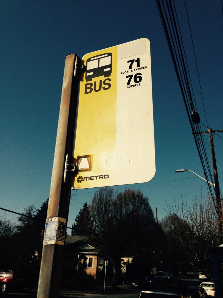
FullSizeRender

We asked around, and this Metro stop sign, with the daisy logo in the lower left corner, dates to at least the mid-1990s. (Stop #38000, west-bound on NE 65 Street and Ravenna Ave NE).


For example: Could you imagine life without the good ol’ 71 Express? It’s tough, especially for residents in Wedgwood and View Ridge where service would be reduced. But what if it were replaced by a heavily revamped Route 16 that arrived every 15 minutes (instead of the 71’s 30 minutes) and created an enhanced east-west transit corridor from Green Lake all the way to Sand Point Way? Are residents willing to walk a little further for changes like these?

More on the map I mentioned above: For a visual, flipbook-style look at present service and proposed changes, we recommend checking out the map found in this Seattle Transit Blog post. Hover your cursor over the map image found there, then click and hold the vertical white line. Move the line left and right to see the changes.

The Seattle Transit Blog posted their take on the changes proposed for Northeast Seattle routes earlier this month. If one is looking for more detail about the proposed changes (and what the differences between Alternate 1 and 2 mean), their post is a good read. Included in the post is a list of route-by-route changes for riders wondering what their new alternatives would be.

UPDATE (6:39 PM): Alternative 1 Montlake Triangle Vicinity Routes map:


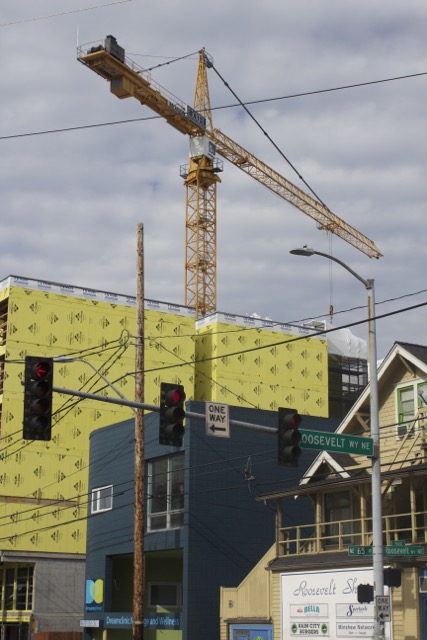
Here they come to snuff the Rooster (crane)

Aww yeah*.

One of the two large cranes gracing the downtown Roosevelt skyline is moving on.

Rooster_crane

The Roosevelt Neighborhood Association has received word from the developer of the Rooster Apartments (902 NE 65th Street) that their contractor’s large construction crane is coming down on Saturday, February 28th. “NE 65th street will be shut down in front of the Rooster from 6am to 6pm. Traffic control will be on site detouring traffic around the site.”

Occupancy of the approximately 195-unit apartment building is still scheduled for the first week of August, says the developer (Lake Union Partners), with one of the first floor tenants, a fourth Portage Bay Cafe, opening this summer as well.

____________________

*Headline and first sentence by Alice in Chains, of course. Probably the last time we’ll use it. Probably.

Public School First Day of Class Eve power outages (UPDATES)

If your VCR is blinking “12:00” when you get home tonight, this is why:

power_outage_sept_2

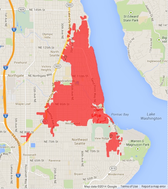
Around 3:30 this afternoon, Seattle City Light customers along NE 75th Street from Roosevelt to View Ridge lost power. About 3700 customers were affected, with the cause listed as “Tree” on the city’s power outage page.

Then, about an hour later (after partial restoration to the earlier affected area), a large wedge-shaped swath north of about NE 80th Street between Lake City Way NE and Lake Washington also lost power. About 8,600 customers are affected in this area, with many traffic signals on Lake City Way and other arterials out.

Seattle City Light has crews dispatched and estimates the time of restoration to be 7:20 PM. Cause for this second, larger outage is also listed as “Tree.”

An online weather station in the Bryant neighborhood registered four gusts of wind above 20 mph after 2 PM. The barometer continues to fall as well, so we may be in for more blustery weather.

UPDATE (5:43 PM): Seattle City Light saying on twitter that many customers should start seeing power back in the next 45 minutes.

UPDATE (10:08 PM): A brief yet heavy rain around 6: 20 PM knocked out power to another small group of homes. SCL saying at this time that approximately 482 customers are still without power. Estimated restoration time for this group — 34th to 46th Avenues NE on the west and east, and NE 110th to 97th Streets north and south — is after midnight, possibly 2 AM.

Rollover collision near northbound I-5/Lake City Way exit

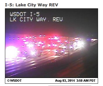
Shortly after 3 AM, Seattle Fire Department units responded to a rollover collision near or on the I-5 offramp to Lake City Way.

I5_LCW_MCI

Via scanner, we’ve learned there are six patients: Three patients with life-threatening injuries and three with non-life-threatening All six have been transported from the scene to area hospitals in stable and with non-life-threatening injuries, the fire department said via twitter.

The collision has the two right lanes of I-5 blocked, with traffic slowly moving through on the left. We expect northbound traffic on I-5 through the area to be impacted for some time as the collision is investigated.

You can see current highway conditions and the I-5/LCW WSDOT camera here.

UPDATE (7:06 AM): Washington State Patrol has more information on this incident:

Northgate Link update: Brenda now 500 feet closer to Roosevelt

Today’s Northgate Link Extension news from Sound Transit includes a tunnel boring machine (TBM) update.

Maple Leaf Portal/tunnel boring news


View TBM Brenda’s current position (as of July 31, 2014) in a larger map

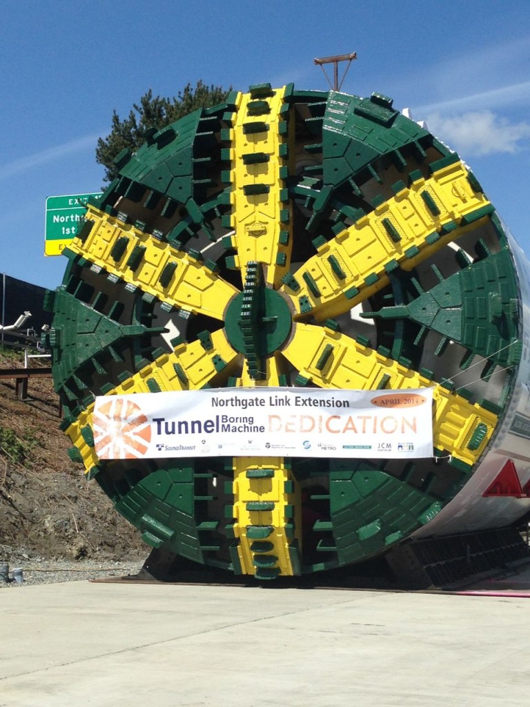
Sometime today, Thursday, July 31, TBM Brenda will have chewed her way through 500 feet of Maple Leaf soil on her way south to Roosevelt Station. Another TBM now being assembled at the Maple Leaf Portal will start carving the southbound light rail tunnel sometime in October.

TBM_Brenda_dedication23

I’m guessing Brenda is a bit dirtier these days.

Roosevelt Station news

Station box wall construction now complete, the main work at the Roosevelt Station construction site is now the *excavation* of said station box. Crews are digging down about four feet at a time, removing soil from the station box area, pausing to stabilize the station walls that have been newly revealed, and then digging some more.

The station box needs to be fully excavated by the time Brenda arrives, sometime in early 2015.

And now for some NE 65th Street detour news:

In mid to late August, drivers heading past the Roosevelt Station site on NE 65th Street during the day may be detoured due to a project to install water lines under the road at the intersection of NE 65th Street and 12th Avenue NE. The signed detours will be in place from 7 a.m. to 3 p.m. weekdays. Westbound drivers can expect detours via 12th Avenue NE, NE 70th Street and Roosevelt Way NE and eastbound drivers can expect detours via 12th Avenue NE, NE 75th Street and 15th Avenue NE. Only one direction of travel will be detoured at a time.

These detours combined with the work on the Rooster Apartments on the west side of Roosevelt Way NE are making travel on NE 65th Street through the Roosevelt neighborhood a pain for all concerned (drivers, pedestrians, cyclists, etc.). We urge all travelers in the area to have some patience and practice grace-filled egress in the area.

U District Station News

This week, crews are digging holes in which to place piles that will make up the southern wall of the station: 76 holes, each between 50 to 105 feet deep. To help speed this work along, crews are now on site on Saturdays AND using two drill rigs.

NE 43rd Street east of Brooklyn Avenue NE is still closed to motorists, but what are you doing driving around in that area anyway it is a mess.

Northgate Link webcams

If you’re sitting near internet and wondering how construction is doing at any of the above locations, there’s a webcam (or three) for that:

Each page also has a “Stream Time-Lapse Movie” button on the left-hand side, for those who appreciate more action than a live shot once every 15 minutes.

20140731_SaturdayConcretePourUPDATE (2:17 PM): Just into the Ravenna Blog inbox is a Roosevelt Station construction alert for Saturday.
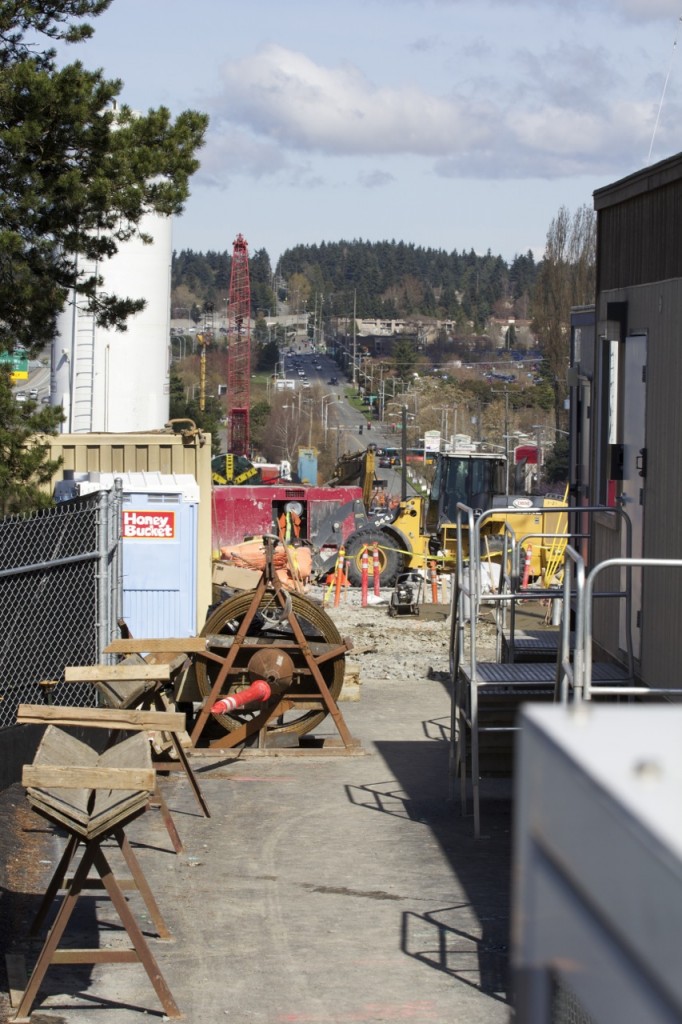
Saturday morning concrete pour at Roosevelt Station construction site

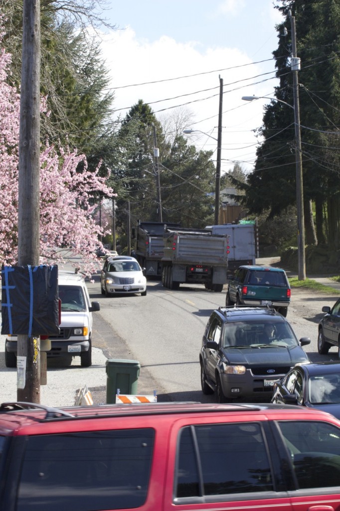
On Saturday, Aug. 2, construction crews working for Sound Transit will begin work at 7 a.m. for a concrete pour. Residents may notice noise from truck engines.

Crews will do everything within reason to keep noise to a minimum.

Why is this concrete pour happening on Saturday?

High demand for concrete resulted in limited schedule availability for the concrete pour at Roosevelt Station. Doing the work on Saturday morning will help keep the project on schedule by at least two weeks.

Road safety improvements coming to NE Blakeley Street / Union Bay Place NE

Some well-known traffic trouble spots near University Village are getting some overdue attention next month.

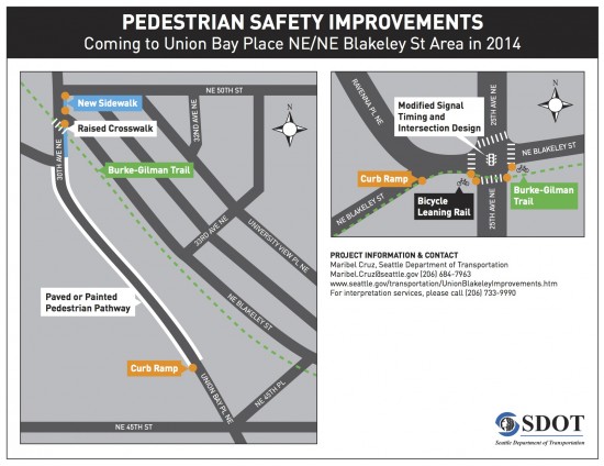
UnionBlakeleyProjectMap

The Seattle Department of Transportation (SDOT) is in the process of designing the following safety improvements to the Union Bay Place NE/NE Blakeley Street area (projected to begin construction as early as August 2014):

  • 25th Ave NE & NE Blakeley Street: Modified signal timing and intersection design. New bicycle leaning rails* (allow cyclists to wait for light change without dismounting, placing one foot on the rail).
  • 30th Ave NE & the Burke-Gilman Trail: Raised pedestrian crosswalk and repaired sidewalks approaching this crosswalk along 30th Ave NE between NE 50th Street and Union Bay Place NE.
  • Union Bay Place NE between NE 45th St & 30th Ave NE: New paved and painted pedestrian pathway along both sides.


View Safety Improvements to NE Blakeley St and Union Bay Place NE in a larger map

This work is funded by mitigation from the University Village and the Village QFC as well as Pedestrian Master Plan improvements. You can read more about the mitigation funding of this project on page 17 of this SDOT analysis of QFC’s 2012 land use application (208 KB PDF) to expand the store and build a parking garage.

The pedestrian improvements are part of SDOT’s Sidewalk Development Program and funded by the voter-approved Bridging the Gap levy. The Program’s 2014 projects include these new sidewalk connections:

Questions?  Contact Maribel Cruz with SDOT at 206-684-7963 or maribel.cruz@seattle.gov.

***

*We are looking into the bicycle leaning rails to find out more about them (and see if these will be the first ones installed in Seattle).  We will update the post as we learn more!

Shooting behind U-District Safeway (UPDATES)

Around 5:12 PM, Seattle Fire and Police responded to a shooting on the south side of the Safeway at Brooklyn Avenue NE and NE 50th Street in the University District.


View Shooting behind Safeway in U-District in a larger map

According to information heard over police scanner, some suspects fled the scene in a black Hyundai SUV, traveled through the Roosevelt neighborhood, and attempted to get onto I-5 northbound. The vehicle was spotted and stopped by multiple officers on I-5 just north of Lake City Way. A gun was recovered by officers from the SUV.

Another suspect may have fled the area by a Route 70 Metro bus, getting off on Eastlake near Hamlin.

We’re adding more info as we get it.


UPDATE (6:11 PM): The SPD Blotter has been updated with the following:

Seattle police took five people into custody Wednesday evening following a shooting in the University District, which left one man with serious injuries.
Just before 5:15 PM police received several reports of gunfire near NE 47th Street and Brooklyn Avenue NE.

When officers arrived at the scene, they found a man in his 30s with a single gunshot wound lying on the ground near an alleyway.

Medics transported the victim to Harborview Medical Center with serious injuries and officers began searching the area for several vehicles, which had fled the scene moments after the shooting.

Officers performed two high-risk stops—one on an SUV on Interstate 5 near Lake City and another on a vehicle near 85th and Aurora—and detained five people in connection with the shooting.

6:15 PM: Reports on the scanner of finding bullet damage to the nearby Chevron Station and at least one vehicle (van belonging to University Seafoods and Poultry).

6:38 PM: We’ve heard from a parent that University Child Development School (5062 9th Ave NE) was on lockdown during the incident.

6:43 PM: The Seattle Fire Department reports that the “[p]atient is 40yo male with single gunshot wound in critical condition at HMC.”

And the SPD Blotter post includes this update: “Police arrested the suspected gunman on I-5…and have detained two other people. The other individuals stopped by police have been identified and released, and detectives continue to investigate the incident.”


6:56 PM: The Daily of the University of Washington’s Joshua Bessex just shared another picture from the scene with even more bullet evidence:

Friday, April 4: The Seattle P-I has obtained the narrative from the incident and has written up the details here: “Felon fresh from prison shot man in U-District.” Robert E. Montgomery has been charged with first-degree assault and unlawful gun possession, and remains jailed on $150,000 bail.

Maple Leaf Portal and Roosevelt Station construction (PHOTOS)

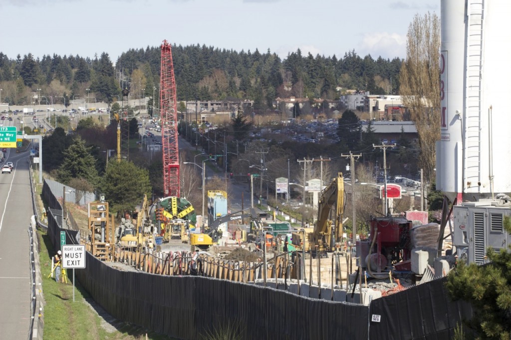
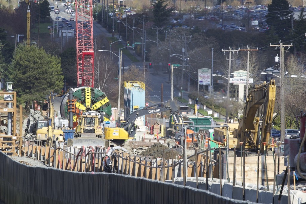
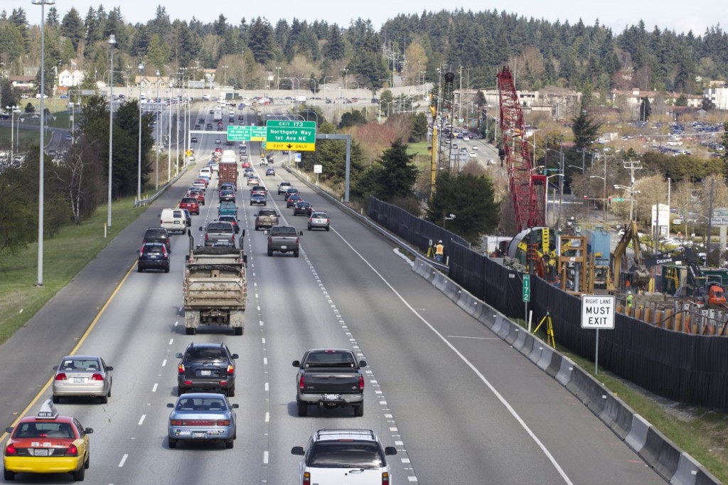
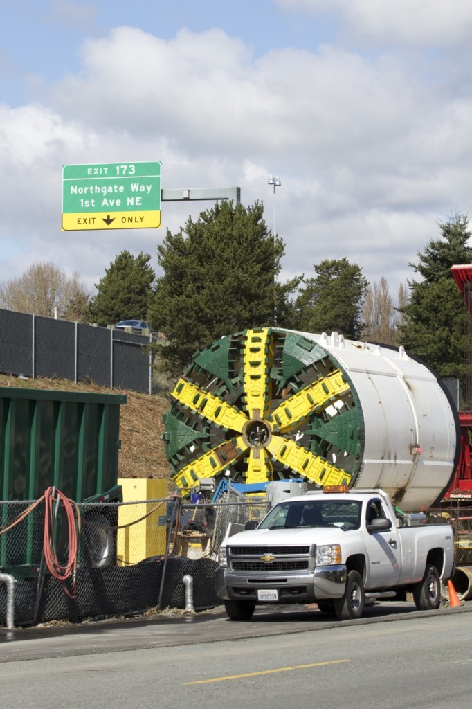
Blessed with some clear skies and lovely spring sunlight, we set out on Friday, March 21 to take some photos of the two Northgate Link sites seeing the most action right now: The Maple Leaf Portal and Roosevelt Station construction sites.

We’ve done our best to explain each scene and the work being done to the best of our knowledge. We will, of course, add additional information for more expert sources if possible.

Each of the photos below can be enlarged with a click of the mouse (or tap of the finger, mobile users).

Maple Leaf Portal

Maple Leaf Portal and Roosevelt Station March 21 01

View from the NW corner of NE 92nd Street and 1st Avenue NE, looking north through the length of the Maple Leaf Portal (MLP) construction site.

Maple Leaf Portal and Roosevelt Station March 21 02

View east from the same corner. Double dump truck headed to I-5 up NE 92nd Street.

Maple Leaf Portal and Roosevelt Station March 21 03

View to the north from the NE 92nd Street overpass. The nearly reassembled tunnel boring machine (TBM) patiently waits its turn. (Here’s a Sound Transit picture of the inside of the TBM during reassembly.)

Maple Leaf Portal and Roosevelt Station March 21 04

Zoom from the same location. Sound Transit recently set up webcams at the active Northgate Link construction sites. The camera surveying the scene at the MLP can be seen on the far left side of the photo above. To see what’s happening from the camera’s viewpoint, visit this here EarthCam page.

Maple Leaf Portal and Roosevelt Station March 21 05

View from the NE 92nd Street overpass of northbound I-5 drivers all wishing they could be riding a train instead of driving. Another double dump truck headed out with muck from either the MLP or Roosevelt Station sites is traveling with them.

Maple Leaf Portal and Roosevelt Station March 21 06

On 1st Avenue NE now. No construction wall here to obscure one’s view of all the equipment and work being done. Looking south a bit here at the TBM.

Maple Leaf Portal and Roosevelt Station March 21 08

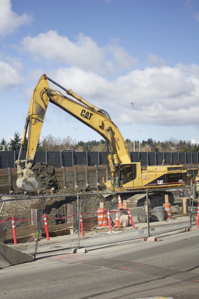
Looking north at a very large excavator depositing soil into a double dump truck.

Maple Leaf Portal and Roosevelt Station March 21 09

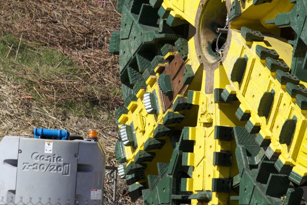
Close up of the TBM’s teeth, catching the spring sunlight.

Maple Leaf Portal and Roosevelt Station March 21 10

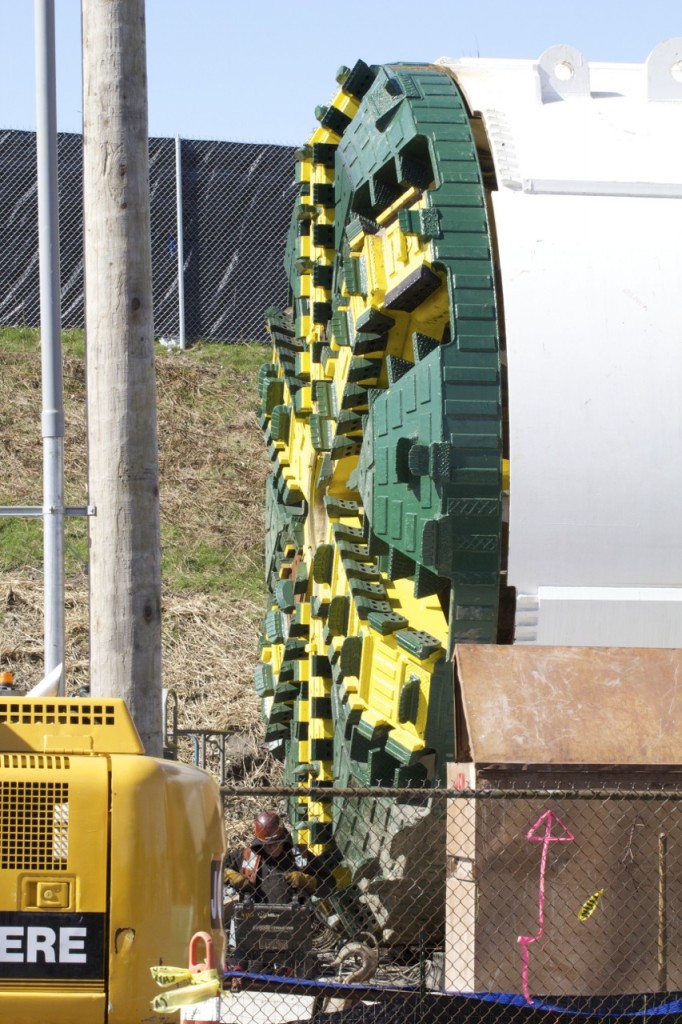
View of the whole cutter head of the TBM, with a worker conveniently seated on the ground nearby for scale.

Maple Leaf Portal and Roosevelt Station March 21 11

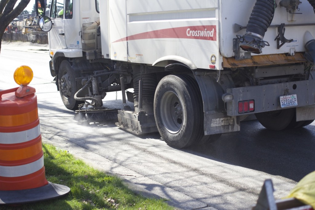
Street sweeper in action. Common sight, cruising near both the MLP and Roosevelt Station construction sites. Part of the overall construction mitigation plan (457 KB PDF).

Maple Leaf Portal and Roosevelt Station March 21 12

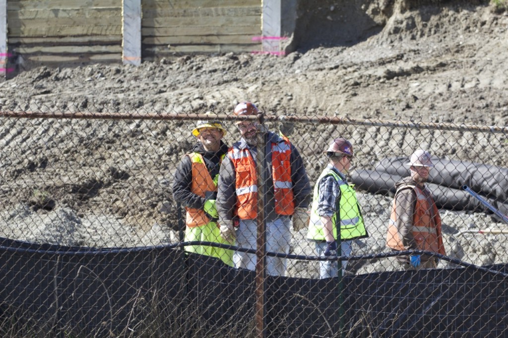
One of the pleasant side effects of doing reporting with a toddler around is that sometimes the construction folks wave and/or make faces. Thanks, guys.

Maple Leaf Portal and Roosevelt Station March 21 13

Should you have any of your own small children or other construction vehicle fanatics in your circle of friends, there is a lovely viewing point on 1st Avenue NE at NE 95th Street which includes a cement wall perfect for sitting on. Perhaps with a sack lunch. Or a froyo.

Maple Leaf Portal and Roosevelt Station March 21 14

Another nice side effect of carrying a cute kid around and using a big zoom lens is that people walking by say HI and ask what you’re doing. And sometimes these people are nice and understanding, and help you get even better pictures from their four floor apartment building. (Thanks, Tom!)

This is looking southwest at the “head wall” of the Maple Leaf Portal. You can see the NE 92nd Street overpass in the background. This head wall is where the TBM will begin its journey down to…

Roosevelt Station

Maple Leaf Portal and Roosevelt Station March 21 15

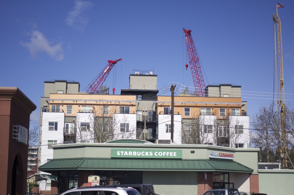
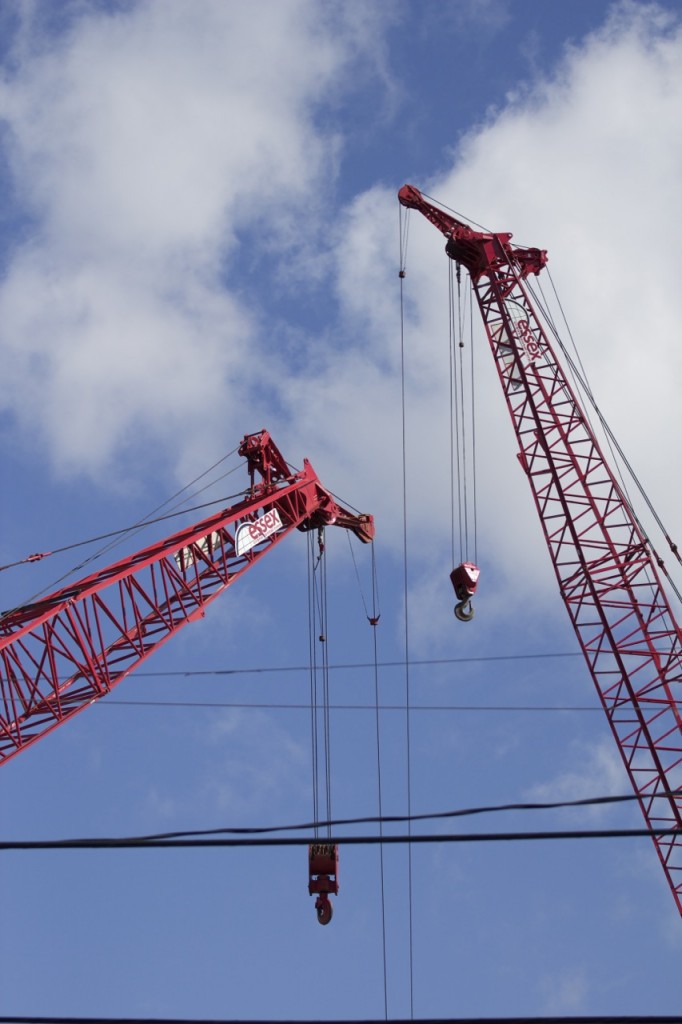
Red crane “rabbit ears” behind the Dwell Apartments. This shot is taken from the parking lot of Roosevelt Square, looking north. We’ve been able to spot these red cranes from all over Northeast Seattle.

Maple Leaf Portal and Roosevelt Station March 21 16

Hugh Sisley sighting.

Maple Leaf Portal and Roosevelt Station March 21 17

Red cranes again. We’ve seen these machines used to move assembled slurry wall rebar cages from one area of the construction area (the Roosevelt Way NE side) to the others.

Maple Leaf Portal and Roosevelt Station March 21 18

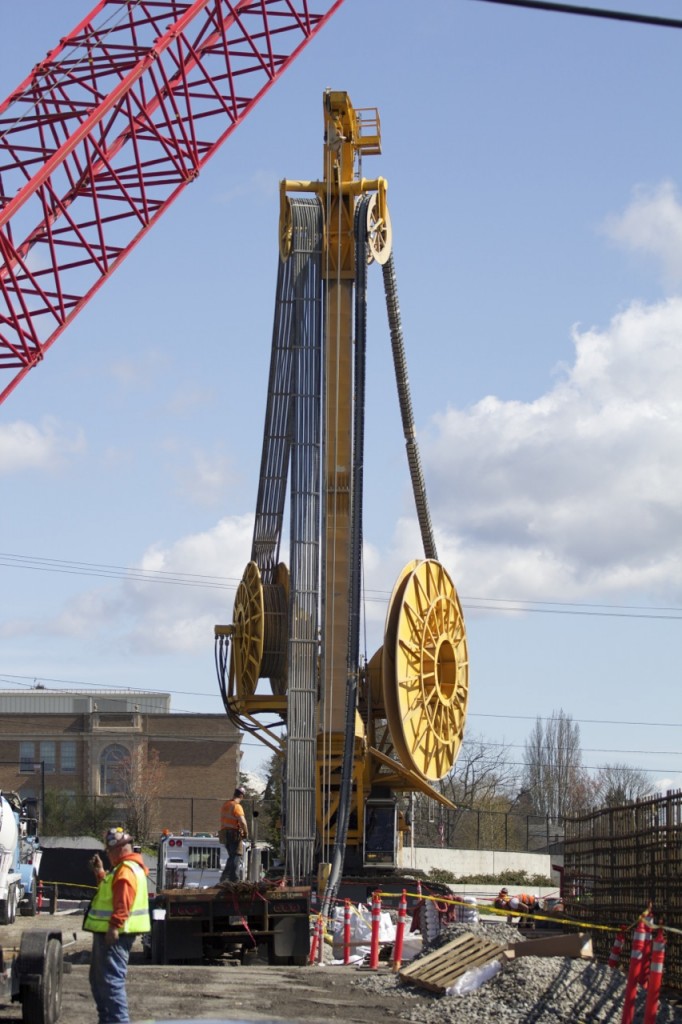
This is a large hydromill, used to dig the 130-feet-deep-plus slots into which the rebar cages are later lowered. Then cement is pored in, creating the “slurry walls” that make up the outer walls of the underground station. The walls of the station are built underground BEFORE excavation happens!

Maple Leaf Portal and Roosevelt Station March 21 19

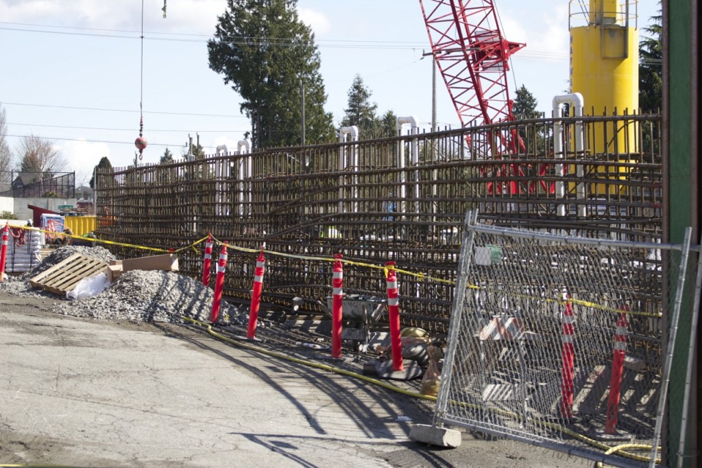
One of the rebar cages in some state of assembly.

Maple Leaf Portal and Roosevelt Station March 21 20

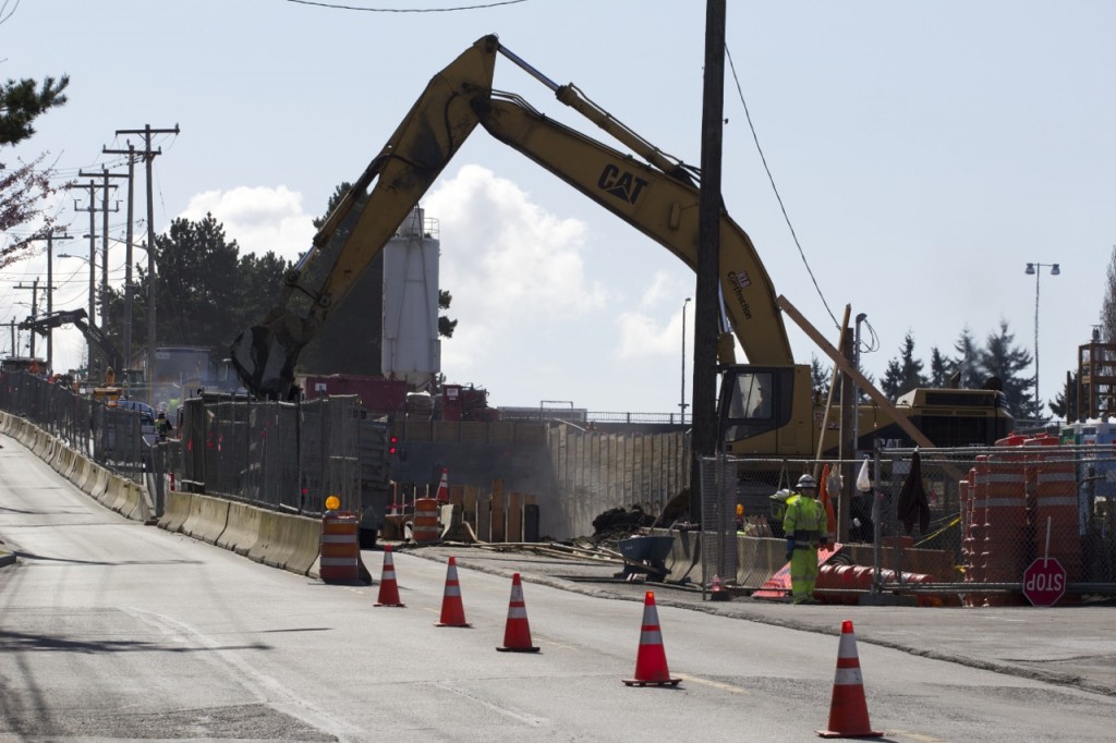
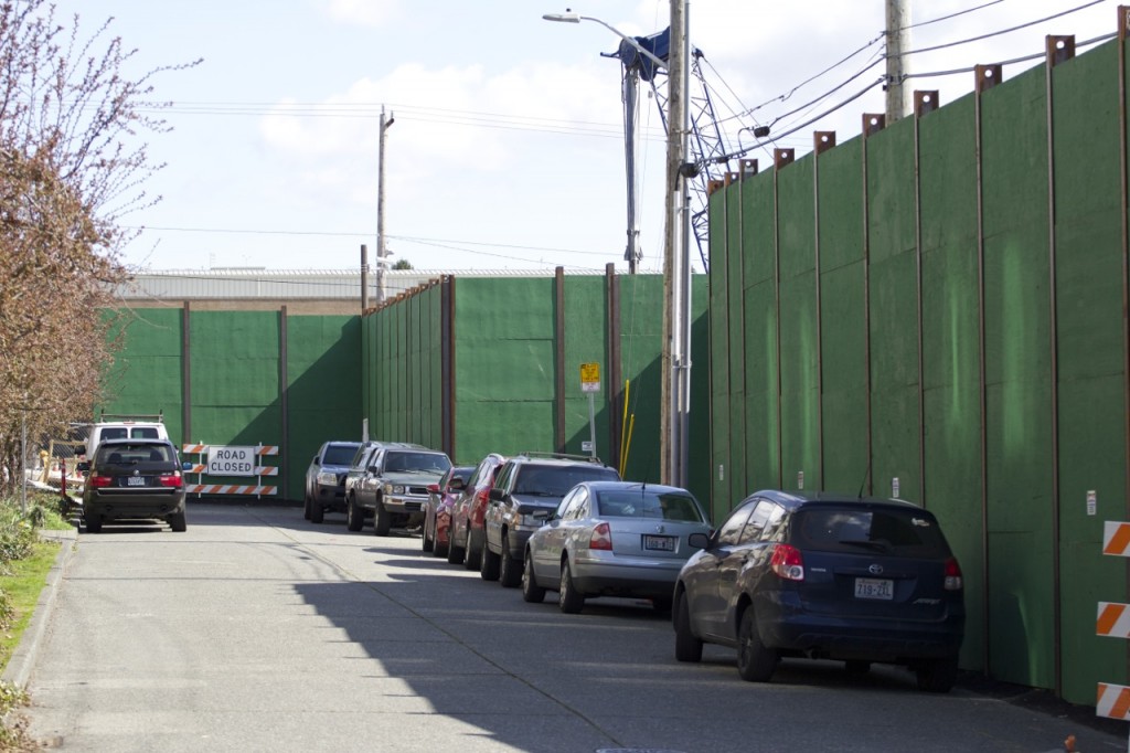
Unlike the Maple Leaf Portal site, the Roosevelt Station area has many thick and tall construction walls up already. This is great for local residents — part of the construction mitigation which lessens noise and reduces dust — but not so great for taking pictures. Looks good, though. A Roosevelt High School-inspired green.

Maple Leaf Portal and Roosevelt Station March 21 21

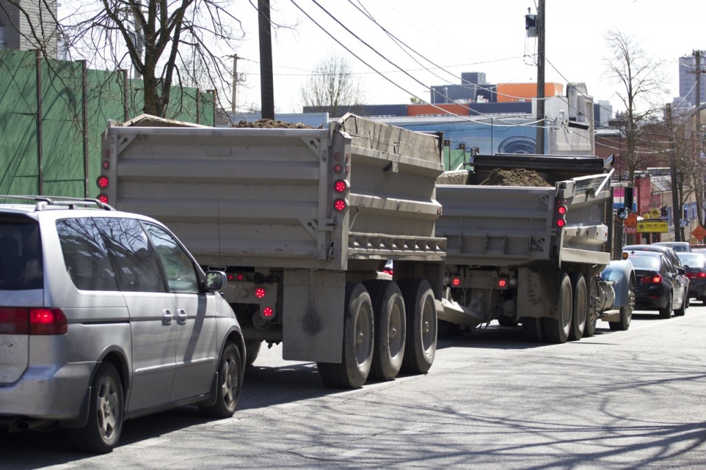
O HAI, double dump truck. Looks like you forgot to cover your load. *wags finger*

Maple Leaf Portal and Roosevelt Station March 21 24

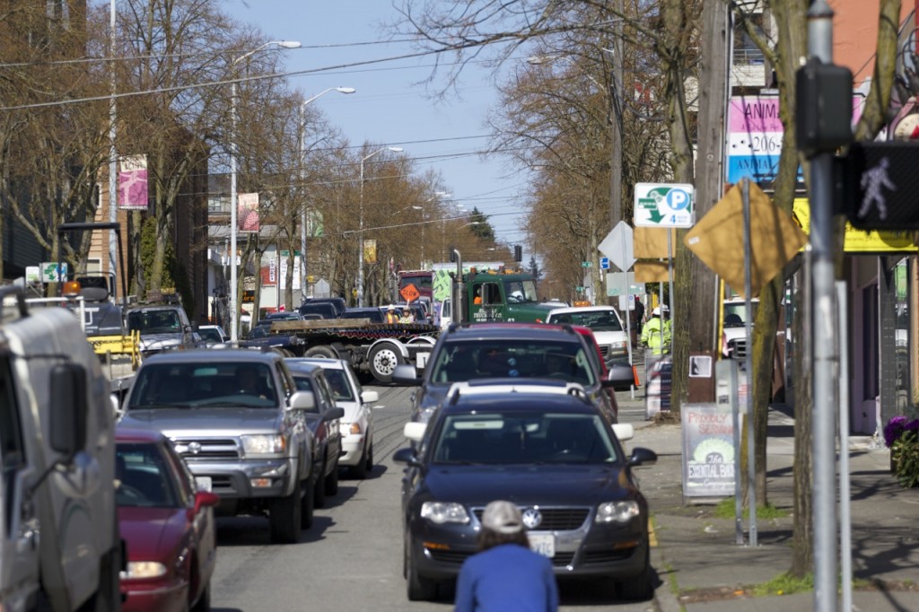
Construction-related vehicles have two entrances/exits at the Roosevelt Station site: One on 12th Avenue NE, and the other on Roosevelt Way NE. Above is a large truck backing out of the Roosevelt Way NE side with the help of a flagger.

Maple Leaf Portal and Roosevelt Station March 21 25

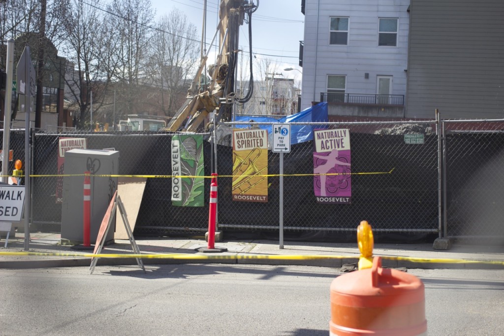
A little local flair/signage on the site’s chain link fence. This temporary fencing along 12th Avenue NE will be replaced by more thick, green construction wall in the future.

Maple Leaf Portal and Roosevelt Station March 21 26

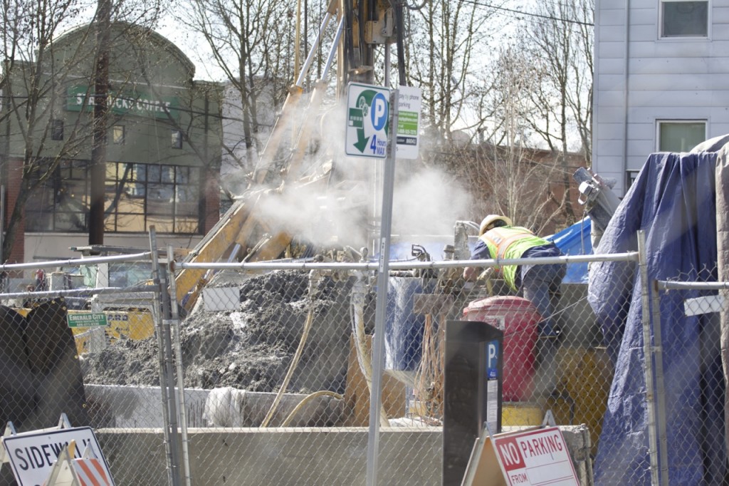
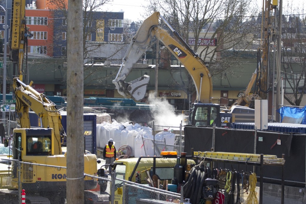
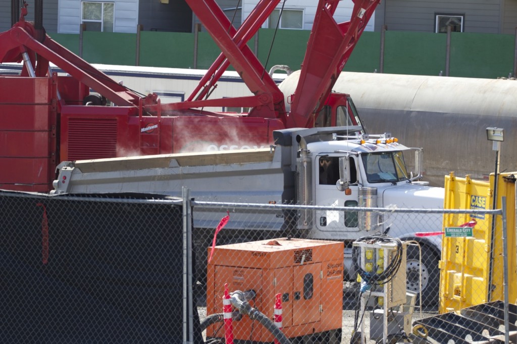
Excavation work being done at what will be the southern entrance to the finished light rail station, on the NW corner of NE 65th Street and 12th Avenue NE. The piles of soil were steaming in the cool spring sunshiny air (though we suspect that part of this is due to heated water used in the excavation process — looking into it).

Maple Leaf Portal and Roosevelt Station March 21 27

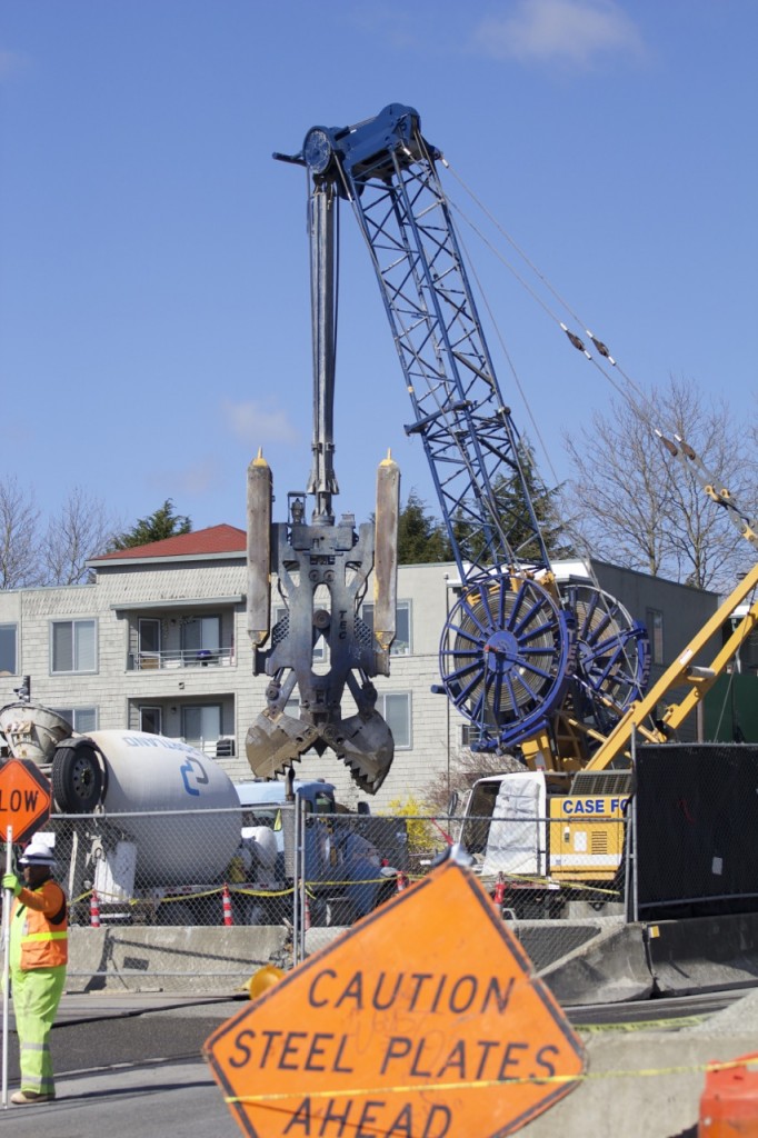
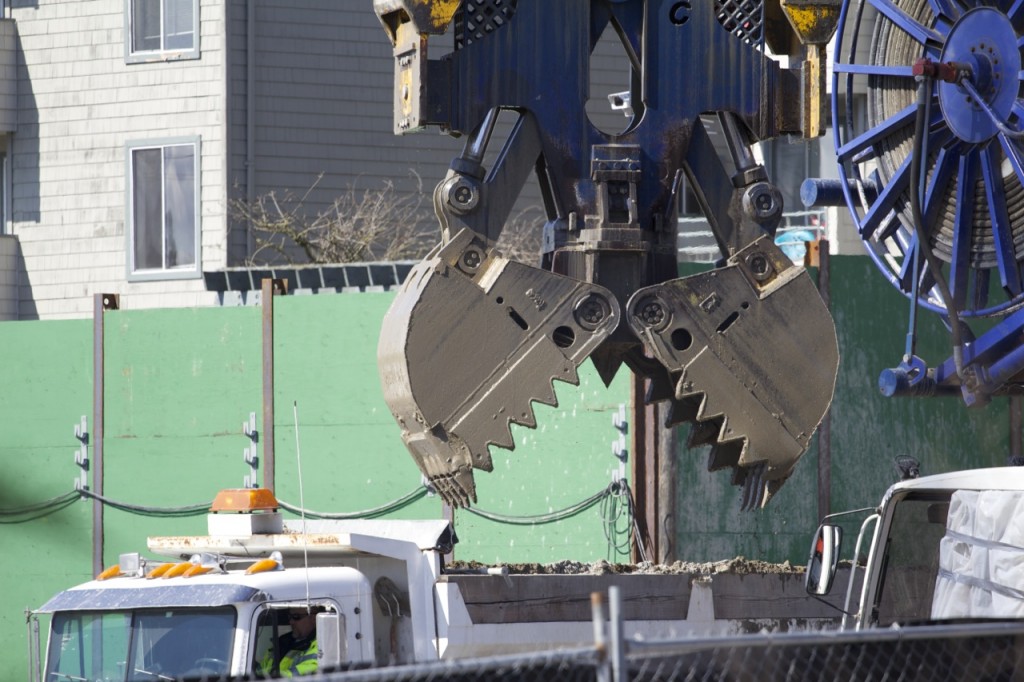
Another, smaller hydromill, working in the NE corner of the construction site (near where the northern station entrance will be located). Here, the jaws just emptied a load of soil into a mostly hidden dump truck.

Maple Leaf Portal and Roosevelt Station March 21 35

Close-up, post dump. Look at those chompers!

Maple Leaf Portal and Roosevelt Station March 21 28

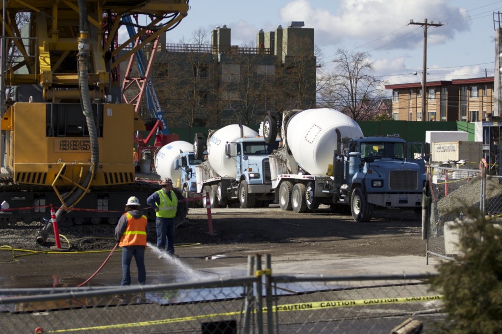
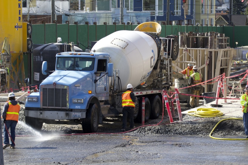
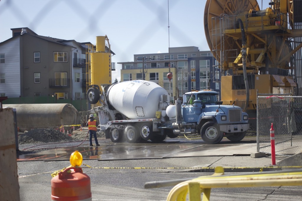
Lots of cement trucks on this day. They were queued up three or four deep, waiting to their turn to pour.
Maple Leaf Portal and Roosevelt Station March 21 37


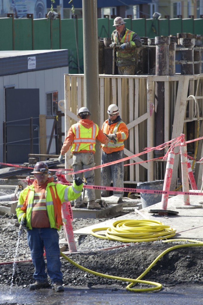
Cement truck during a pour near the center of the construction site.

Maple Leaf Portal and Roosevelt Station March 21 31

All vehicles leaving the site get a wheel washdown, another piece of the construction mitigation package.

Maple Leaf Portal and Roosevelt Station March 21 39

Close up after the pour was finished.


Maple Leaf Portal and Roosevelt Station March 21 29

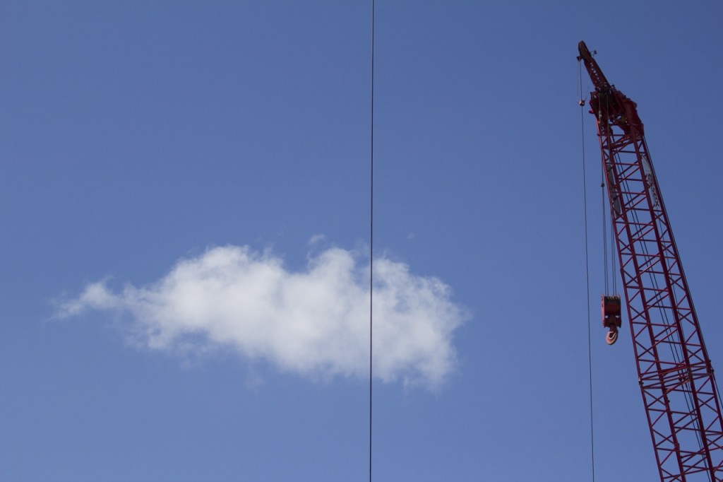
Happy little cloud.

Maple Leaf Portal and Roosevelt Station March 21 30

Cozy bit of sidewalk along the east side of 12th Avenue NE. The cement wall on the right side is the west side of the Roosevelt High School track and field.

Maple Leaf Portal and Roosevelt Station March 21 32

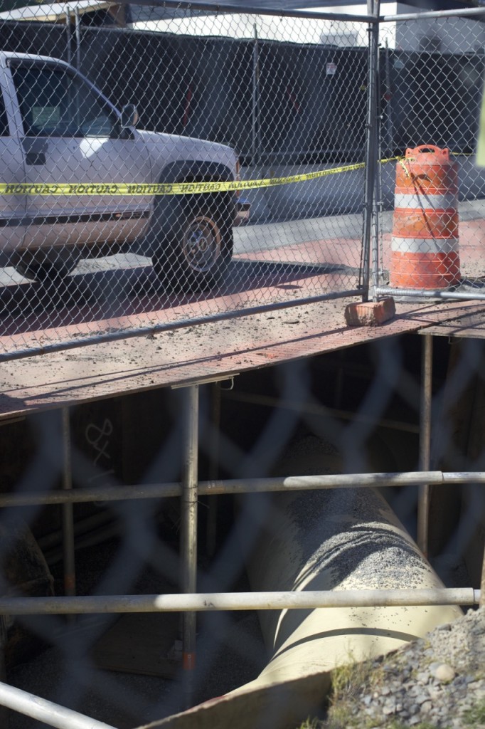
Another part of the construction mine field that is now the Roosevelt neighborhood is a new 42-inch sewer main under 12th Avenue NE. You know those metal plates you drive over? This shot shows you how deep the hole goes underneath your tire.

Maple Leaf Portal and Roosevelt Station March 21 33

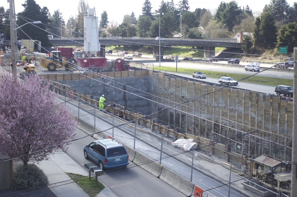
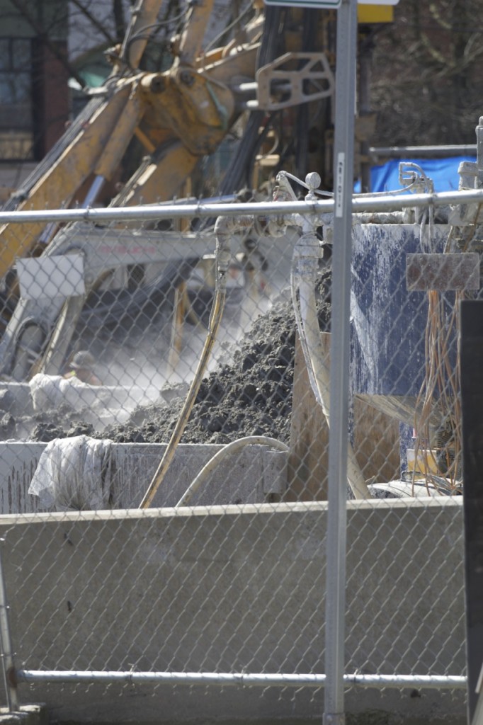
Soil excavation at the southern end of the construction site, along NE 65th Street.

Maple Leaf Portal and Roosevelt Station March 21 34

Excavated soil being transferred into an awaiting dump truck.

Maple Leaf Portal and Roosevelt Station March 21 36

View from the east side of the site of the rebar cage construction.

Maple Leaf Portal and Roosevelt Station March 21 40

More steamy soil, moving out.

Maple Leaf Portal and Roosevelt Station March 21 41

Close-up of steamy soil. (It looked really neat in real life, as the clouds of steam were carried away by the breeze. Trust me.)

Maple Leaf Portal and Roosevelt Station March 21 42

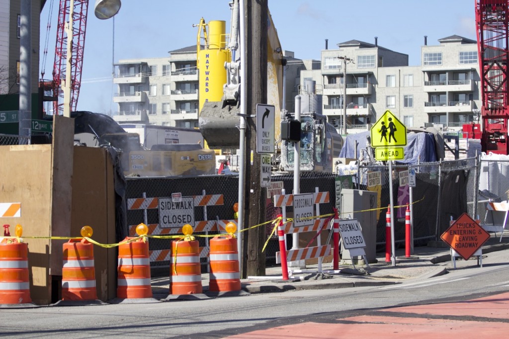
The NW corner of NE 65th Street and 12th Avenue NE. Decidedly closed sidewalk, but that doesn’t always stop Roosevelt High School students trying to cross the street at open campus lunchtime.

Maple Leaf Portal and Roosevelt Station March 21 43

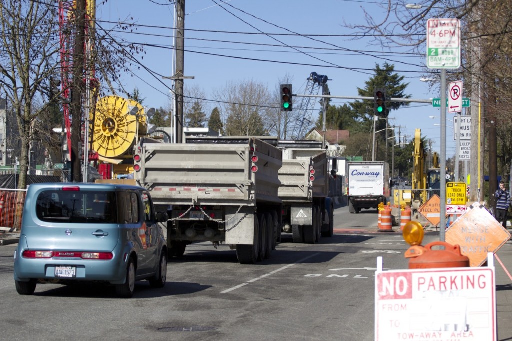
An empty double dump truck headed up 12th Avenue NE, ready to fill up with another load of excavated soil.

Memorial walk and rally planned for March 25; part of “Safe Roads” week

Tuesday, March 25, marks one year since the drunk driving crash that killed Judy and Dennis Schulte and severely injured Karina Ulriksen-Schulte and her newborn baby boy, Elias.

MCI_memorial04

To commemorate the day, the Wedgwood Community Council and the Ravenna-Bryant Community Association have organized a memorial walk and rally, starting at Top Pot Doughnuts (6855 35th Ave NE), and ending on the front lawn of Eckstein Middle School (3003 NE 75th St). A moment of silence will be held at the crash site at approximately 4 PM.


View Wedgwood DUI crash memorial walk and rally in a larger map

NE 75th Street will close to traffic from 31st Ave NE to 35th Ave NE during the walk (3:15-4:15 PM).

The rally at Eckstein will include speakers representing the Seattle Department of Transportation, Prevention Works in Seattle (WINS), Wedgwood Community Council, Ravenna-Bryant Community Association, and Seattle Neighborhood Greenways Group, as well as:

  • Dan Schulte, Father, Husband and Son of Wedgwood crash victims
  • Marilyn Schulte, Daughter of Judy and Dennis Schulte, Aunt to Elias and Sister-in-law to Karina
  • Darrin Grondel, Director, Washington Traffic Safety Commission
  • Senator David Frockt, (D) 46th Legislative District
  • Courtney Popp, Mothers Against Drunk Driving

This event on March 25 is the first in a week-long series of events promoting “Safe Roads Awareness Week,” and focuses on raising awareness of the need for DUI prevention and stricter DUI laws.

safe-roads-awareness-week-logo_with-date

A summarized schedule of events for the rest of the week includes:

Wednesday, March 26th, Distracted Driving Day
The Wedgwood Community Council (WCC) and volunteers will be holding signs during the morning/evening commute to remind folks that the phone call or text can wait.

Thursday, March 27th, Slowdown Day
Again, the WCC and volunteers will be holding signs at a busy intersection during morning/evening commutes.

Friday, March 28th, Share the Road
Again, the WCC and volunteers will be holding signs at a busy intersection during morning/evening commutes. SDOT will make a major traffic safety project announcement.

Officer-involved collision in Roosevelt (PHOTOS, UPDATE)

75th_12th_collision1

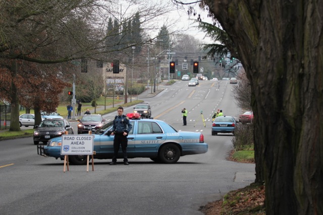
Looking west down NE 75th Street from Brooklyn Avenue NE toward the scene.

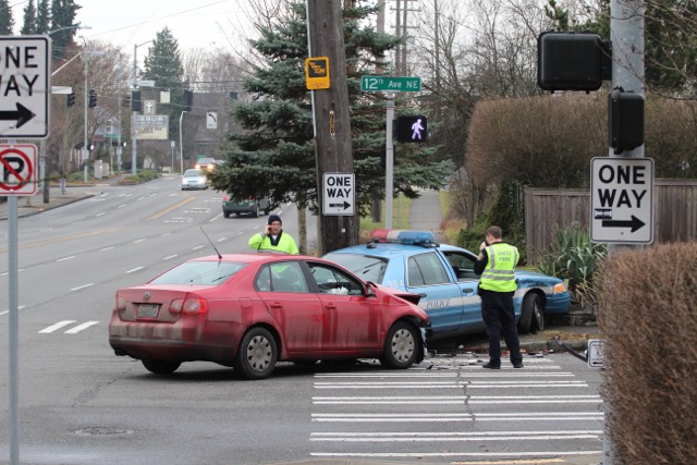
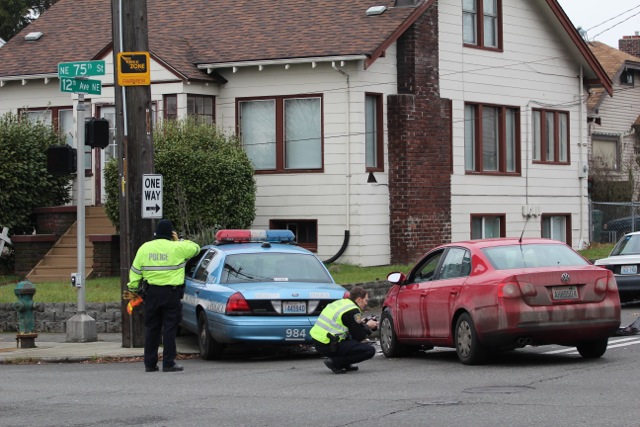
Shortly before 2 PM on Sunday, December 29, Seattle Fire Department units responded to a two-vehicle collision on NE 75th Street at 12th Avenue NE. A red sedan and a Seattle Police Department cruiser had collided and both come to rest near the northwest section of the intersection.

75th_12th_collision4

Close-up of the collision scene, looking west on NE 75th Street.

According to Seattle Fire Department PIO Lt. Sue Stangl, all three people involved (one officer in the patrol car and two people in the red sedan) were transported to hospitals with minor injuries. The officer was transported to Harborview, which is standard procedure for the Seattle Police Department.

75th_12th_collision2

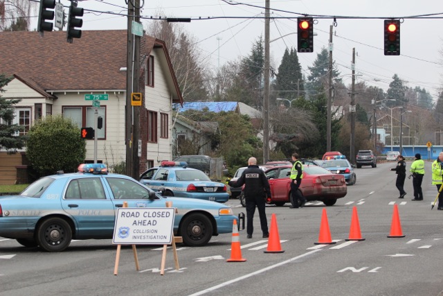
Looking north down 12th Avenue NE.

Detours were in place to reroute traffic as investigators processed the scene, but at least some Metro bus routes were unaffected.

75th_12th_collision3

Close-up of the two vehicles looking north down 12th Avenue NE.

UPDATE (8:58 PM): We heard from a resident close to the scene that NE 75th Street reopened to traffic just before 6 PM. And, prior to that, a neighbor brought the officers directing traffic some cookies.